
Geospatial Platform
Bring R&D projects to production
Rapid
Accelerate R&D and accomplish years of work in just weeks.
Reduce overhead
Decrease infrastructure costs associated with R&D and deliver results for a fraction the costs of a DIY approach.
Faster to market
Reduce time to test & productize and gain an advantage over competitors building in-house solutions
Science-ready
Science-ready data available through a single interface, no matter the data type.
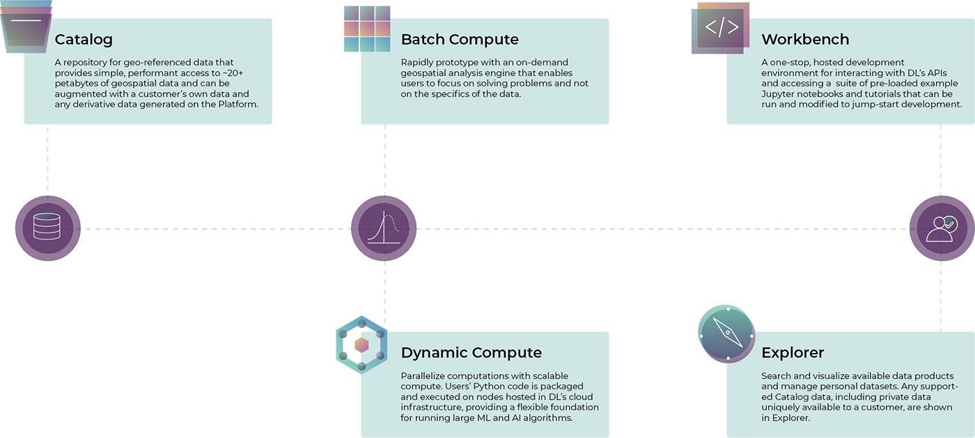
Data
- Access a growing catalog of data.
- Petabyte-scale storage capabilities with user, group, and org-level permissioning. Our catalog natively supports uploading NumPy arrays, Cloud-Optimized GeoTIFFs (COGs), JPEG2000 (JP2), geospatial vector data, and arbitrary blob data.
Modeling
- Dedicated compute resources for large-scale modeling. Up to 1000 parallel workers per pipeline. Workers as large as 16 vCPUs with 120 GB memory.
- Dynamic compute.
- Each user gets a VM with a robust Python environment.
Support and Services
- We work with you to define your needs.
- Everything from help desk to science consulting to data pipeline setup.
Security
- ISO-27001 certified.